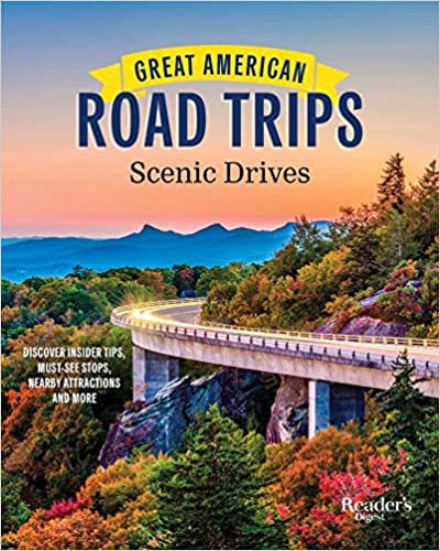
I remember as a kid going on road trips with my family early 60s. It was always so exciting to jump in the car and take off to parts unknown. If you take your time, it’s the best way to see America. Great American Road Trips: Scenic Drives by Reader’s Digest, is a bible every road tripper should have.
You can purchase Great American Road Trip: Scenic Guide on Amazon by clicking here.
The book is a compilation of scenic drives throughout the United States with commentary by travelers who know the routes backward and forward. They describe the drive, point out various side trips, and give you tips on sights and activities not to be missed.
It covers the best road trips in the United States so that all you have to do is jump in your car and start driving.
I’ve been a Californian since I was 3 years old, and have always been especially interested in points West like the Big Sur Coast and California U.S. Route 395.
There are amazing road trips described in the book. If you have a funky car, you can always pick up a rental, follow your route of choice from the book, and take in the sights.
Drive along the Apache Trail in Arizona, probably not in summer, or Great River Road through Wisconsin, Minnesota, and Iowa.
See the gorgeous autumn leaves along the Historic National Road in Maryland where stagecoaches used to travel, or check out lighthouses, cranberry bogs, and ocean views on Cape Cod’s Route 6. We drove that route once with my family in the winter. There were no tourists there at the time, and it was cold but I enjoyed it. I’m sure spring and fall must be amazing!
How about driving through Amish Country in Central Pennsylvania? I’ve always thought that would be fascinating.
There are so many spectacular views throughout the United States that sometimes I wish I had 100 years left to see it all.
An Excerpt
OAK CREEK CANYON
Red rocks, steep switchbacks, and dramatic views make this Arizona drive a nail-biter.
Story by Marija Andric
Excerpted from GREAT AMERICAN ROAD TRIPS: SCENIC DRIVES, A Reader’s Digest Book, copyright © 2020 by RDA Enthusiast Brands, LLC. Used by permission of Trusted Media Brands, Inc., New York. Available wherever books are sold.
Growing up in Arizona, I loved the biodiversity of the state. Minutes from my home, I could hike the best trails in the Sonoran Desert, and after a few hours of driving, I could breathe fresh alpine air and marvel at fall foliage. And there’s one scenic drive in Arizona that has it all: Oak Creek Canyon.

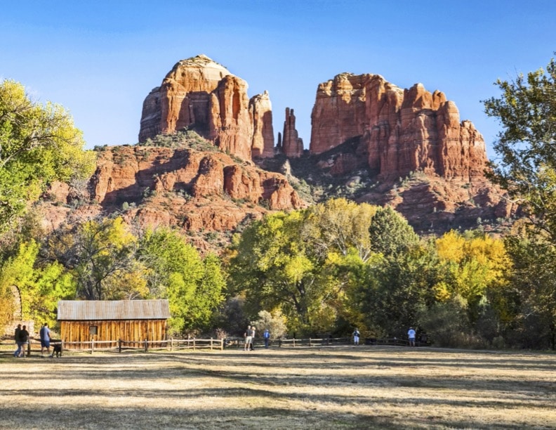
Photo Credit: Danita Delmont/Alamy Stock Photo
This 15-mile state-designated scenic road along Route 89A begins in Sedona (if you’re coming from Phoenix) and winds its way north to Flagstaff. It curves up the Colorado Plateau from the high desert to a landscape of ponderosa pines.
Getting to the start of the drive is a treat for the senses. Route 89A rolls through Oak Creek Village, passing iconic red rocks that are named for their shapes. The landscape has an unearthly feel, and its singular beauty is unforgettable. Bell Rock, which is just off the road, is a popular spot to pull over for pictures or go on a hike along the lower, easier trail.
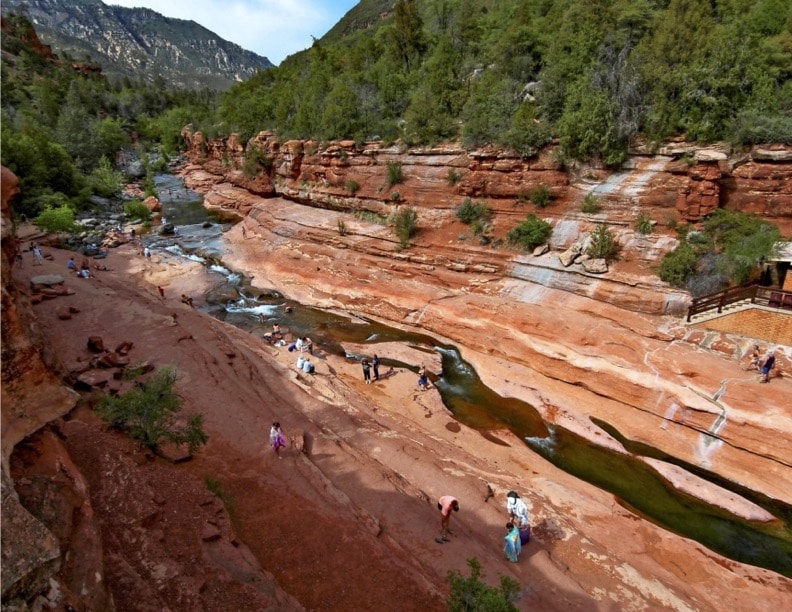
My family and I took this drive in the summer to escape the dry desert heat and in the fall to see the foliage, which begins to turn in November. After crossing the Midgley Bridge, our first stop was Slide Rock State Park, a 43-acre historic apple farm that was at one time the Pendley homestead. Growing apples in the high desert sound far-fetched, but Frank Pendley mastered an innovative irrigation technique in 1912 that allowed his orchards to thrive. In fact, today park officials still use the same technique to water the remaining heirloom trees.

Photo Credit: Pat Canova/Alamy Stock Photo
Though the apple orchard is amazing, the main attraction is the park’s namesake natural slide, which is a slippery chute of worn sandstone about 80 feet long and up to 4 feet wide. The waters of Oak Creek, which carved this canyon, are icy cold and refreshing. Children and adults alike squeal in delight as the water carries them down the slide into a pool.
Algae makes the rocks especially slippery, so it’s important to wear water shoes. It’s also important to look up and appreciate the canyon walls and cliffs that surround the park. I’ve never been disappointed by that view.
Back on the highway, you could easily stay in your car to take in the sights, but along the road, a few picnic sites, campgrounds and overlooks, such as Banjo Bill and Halfway, are well worth exploring.
The farther you drive, the higher you climb. The air cools, and by the time you reach the West Fork Trail, ponderosa pines appear alongside oaks and junipers. The trail, one of the most popular in the area, follows the west fork of Oak Creek.
In fall, the trees are ablaze with reds, oranges and yellows. The canyon walls soar, and the sound of the moving water soothes. You’ll step onto a paved trail that leads to a footbridge over the creek and Mayhew’s Lodge, the ruins of an old guesthouse that burned down in 1980. At that point, your West Fork Trail adventure begins. The in-and-out hike is about 6 miles round trip.
The thrilling part of the drive begins at Pumphouse Wash. For the following 2 miles, the road curves into a series of switchbacks, each steeper than the last.
If you’re lucky enough to be the passenger, you’ll see some gorgeous views of the canyon. (My mother always kept her head down during this part of the drive.) If you’re the driver, well, you’re probably looking at your knuckles and the road ahead.
Years ago, my husband-to-be and I went on this curvy drive. Though I knew where we were going, he insisted on using GPS. As the GPS attempted to chart the switchbacks, the fine pink line of the road turned into a blob.
It’s a slow drive to the top, but when you get there, be sure to stop at the Oak Creek Vista. Take a look back at where you’ve been, and marvel at the wonder of it all. The elevation changes and the diverse ecosystems of the drive are laid out before you. It’s a popular stop with visitors. The overlook is also home to a market offering Native American arts and crafts.
At this point, you’re on the Colorado Plateau’s southwestern edge. This is commonly referred to as the Mogollon Rim. The air up here is cooler and the forest is thick with pine trees.
The old lumber town of Flagstaff (home to the San Francisco Peaks, Northern Arizona University and Route 66) lies ahead. But that’s a scenic drive for another day.
POINTS OF INTEREST
Length
15 miles
Fun Fact
The dramatic reds and oranges in the rocks of Sedona come from iron oxide, left from a post-glacial ocean that filled the Verde Valley.
Words to the Wise
A Red Rock Pass is required if you want to stop and park your car along the drive.
Side Trip
Thousands of years before Hollywood discovered the red rocks of Sedona and the beauty of Oak Creek Canyon, the Sinagua called this place home. Though they moved on centuries ago, they left behind the Palatki and Honanki cliff dwellings. The sites are open to the public and overseen by Coconino National Forest staff. Call 928-282-3854 to reserve a tour spot.
Nearby Attractions
Lowell Observatory, Flagstaff; Tlaquepaque district, Sedona; Fort Verde State Historic Park, Camp Verde; Sharlot Hall Museum, Prescott; Smoki Museum, Prescott
Make sure to purchase this book next time you’re on the road
Great American Road Trips: Scenic Drives has astonishingly beautiful photography throughout. It’s the type of book you want to read over and over again and then dream about it later.
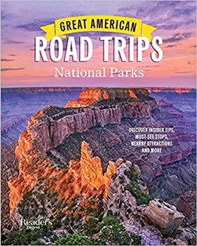
Great American Road Trips National Parks
You will also love Great American Road Trips National Parks. This book is another stunner with gorgeous photos and stories told by road trip travelers in the United States. Our National Parks are incredible to behold and you will want to visit every one of them after reading this book. Both books are perfect for the coffee table and as conversation starters for travel lovers.
You can also read about must-see stops along the way, fun facts, and nearby attractions. It starts from the North West all the way to the South East.
You can purchase Great American Road Trips: National Parks on Amazon by clicking here.


Leave a comment and tell us what you think